CRM Lab


How can we help you?


SECTORS SERVED:

  • Architecture & Engineering
  • Forestry & Oil
  • Public Utilities
  • First Nations
  • Municipal & Provincial Government Agencies
  • Local Heritage Museums & Historical Societies
  • Private Consultation for any Archaeological or Heritage matter


Services Offered:

Development & Planning:

  • Archaeological Overview & Impact Assessments
  • Historical & Archaeological Research
  • Archaeological Survey & Site Recording
  • Archaeological Site Mitigation & Excavation
  • Municipal Archaeological Master Plan Development

Environmental Services:

  • Coordination of Natural Heritage Evalutions
  • Coordination of Oak Ridges Moraine Conservation Plan Conformity Statement
  • Coordination of Phase I & Phase II ESA Projects
  • Coordination of Arborist Reports
  • Coordination of Built Heritage Impact Assessments

First Nation Services:

  • First Nations Engagement
  • Coordination of Projects involving First Nations

Archaeological & CRM Support Services:

  • Project Management
  • Archaeological Mapping & Graphics Services
  • Archaeological Laboratory Services
  • Collections Management
  • Botanical Analysis

Archaeological Education:

  • Public Archaeology Programs
  • In-House Half-Day and Full-Day School Programs
  • Archaeological Laboratory Day Programs
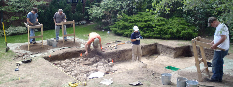
Archaeological Assessments:
Stage 1 - 4

What you need to know


Archaeological assessments are required in advance of residential and commercial development or service projects (i.e. road widening /utility corridors, waste management facilities etc.) in order to meet provincial (Ministry of Culture) and municipal legislation. Archaeological assessments are carried out through background research (Stage 1), intensive field surveys (Stages 2-3), and full site excavation (Stage 4). The early detection of a significant archaeological site through a detailed assessment allows for the early modification of a subject property’s draft plan. Learn more about Archaeological Potential & Your Property.

Stage 1

During archival research of a subject property, archaeological potential is assessed through the identification of any known historic or pre-contact archaeological sites that have been previously registered on the property itself. In addition to this information, archival documents – including 19th century maps and census materials are consulted to determine past land-use practices on the property. Combined with soil and topographical information, this research offers the client the data outlining what may be expected in terms of heritage concerns.

Stage 2

A stage 2 archaeological assessment is an intensive field review of the subject property. An archaeological field crew assesses the subject property under the guidance of a licensed field supervisor. This assessment is typically carried out by means of a 5m pedestrian survey of the subject property. In cases where the property cannot be ploughed, the property may be assessed through shovel test-pitting, in which small pits (30 cm in diameter by approximately 30-70cm in depth) are excavated to sterile subsoil and the materials screened through 6mm (1/4”) mesh. If artifacts are encountered, they are catalogued and analyzed to determine their cultural and temporal affiliation, as well as their archaeological and/or their historical significance. If the deposit is deemed significant, Stage 3 work will be required.

Stage 3

The goal of stage 3 work is two-fold; to define the limits of the archaeological deposit and to determine if the deposit is substantial enough to tell us something about the people who created it. The stage 3 strategy for historic and pre-contact sites is essentially the same - the primary goal is to determine the extent of the archaeological deposit. The first step is a controlled surface collection, where staff record the location of each artifact found on the surface. Subsequently, a map is constructed to reveal the density and distribution of the archaeological resources present. Using standard survey methods, a grid is established across the site and the surface scatter map is then employed to guide the placement and excavation of a series of one metre square test units across the site. Each unit is hand-excavated to sterile subsoil and the soil contents are screened through 6mm (1/4”) wire mesh in order to maximize the recovery of artifacts. The test units and grid are referenced to a site datum, and the location of each unit is recorded on the field map. If artifacts are encountered, they are catalogued and analyzed to determine their cultural and temporal affiliation, as well as their archaeological and/or historical significance. If the deposit is deemed significant, in size, temporal affiliation and cultural material recovered, Stage 4 work may be required.

Stage 4

A Stage 4 requirement demands the total excavation of an archaeological deposit. Stage 4 recommendations can be avoided through the creation of a protected green-space, which surrounds and protects the archaeological deposit. This manner of protection preserves the archaeological site for future generations. However, in many cases, the avoidance of an archaeological deposit is not feasible and the site must be excavated. When this occurs, the excavation of any archaeologically significant deposits will occur within a subject property.